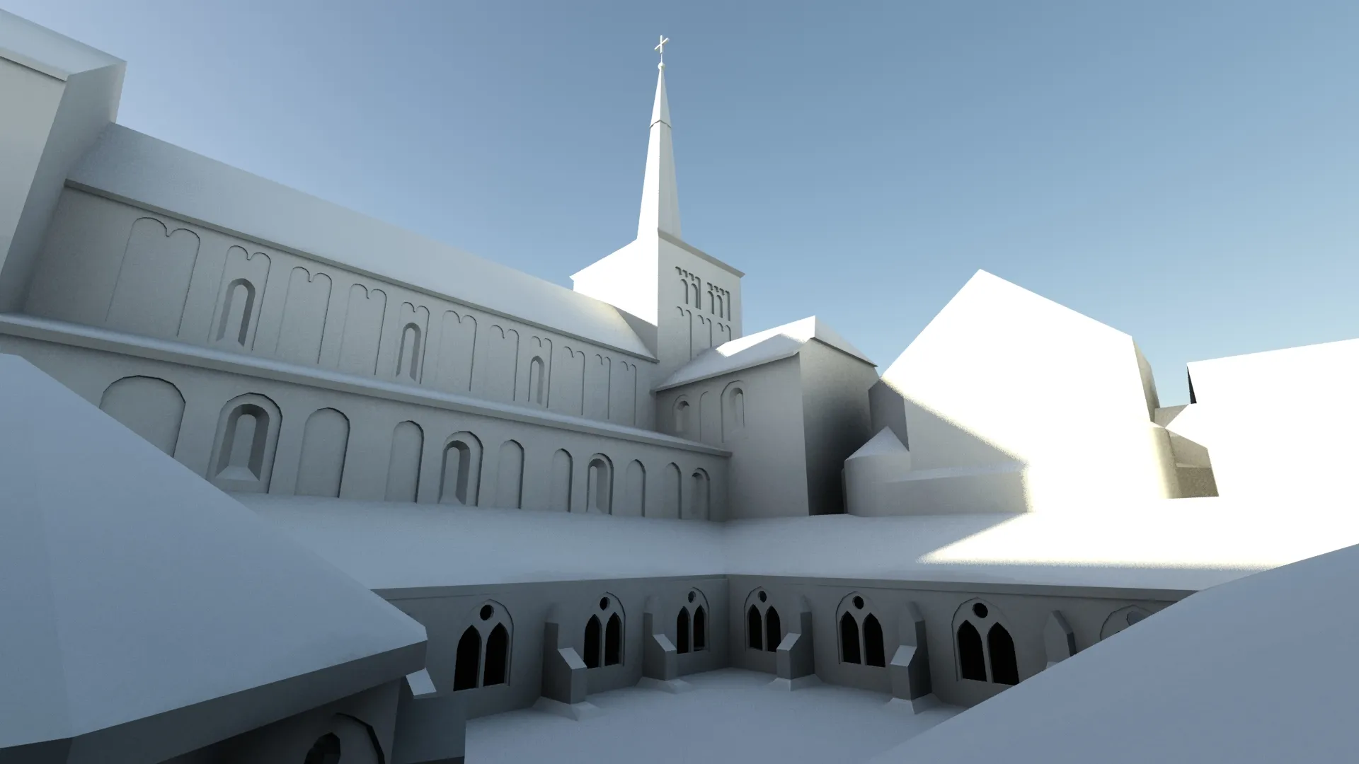

I originally wrote this essay in French. What follows is a translation. You can find the original in L’homme qui sauta par la fenêtre.
Wetzlar (Kingdom of Prussia), 1858. The architect and surveyor Albrecht Meydenbauer, aged 24, steps out of a wooden crate suspended by ropes over the void. He had chosen it over scaffolding to survey the façade of the Church of Our Lady of Wetzlar (the Wetzlar Dom). As he sets his foot on the ledge of one of the windows, he slips and loses his balance, sending his makeshift cradle lurching back and leaving himself in a precarious position. Refusing to plunge to a grim fate, he manages to steer his fall toward an open window below and comes to rest on the steps of a spiral staircase inside. After regaining consciousness, Meydenbauer begins to wonder whether there might be a less dangerous way to measure the inaccessible parts of a building.
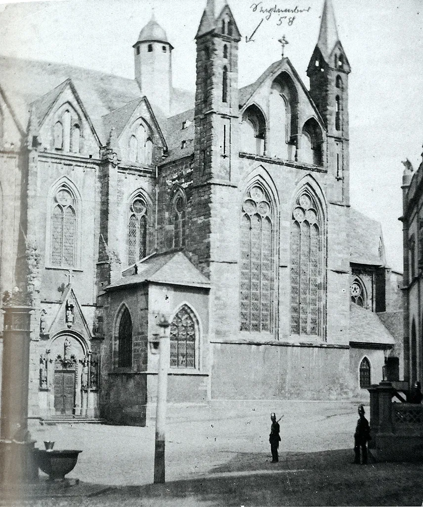
How does one come to risk one’s life to measure a façade? Part of the answer is that we want to hold on to a trace of what we love. And Meydenbauer is neither the first nor the only one. This urge is older than he is.
The architect, who devoted his career to documenting the architectural heritage of Berlin and its surroundings in more than 20,000 photographs, was one of the pioneers of photographic architectural surveying. At the time, surveyors used photography to document their work, but taking measurements remained fieldwork, manual and laborious. Meydenbauer had the idea of applying the principles of projective geometry not to drawing plans from the street, as was customary, but to reversing the process, extracting measurements indirectly from a photograph.
From Antiquity to the Renaissance, on the trail of perspective
Aristotle is thought to have used the principle of the camera obscura as early as the 4th century BC. In a darkened room, the image of the sun’s disc is projected onto a flat surface facing a wall pierced by a small hole (the pinhole). Handy for observing eclipses, the principle was mentioned regularly in the following centuries by scientists and philosophers around the world.
In the 15th century, Filippo Brunelleschi presented a geometric method for painting a portion of observed reality with precision. This period greatly advanced the understanding of perspective, which Leonardo da Vinci describes this way:
Perspective is nothing else than seeing place [or objects] behind a plane of glass, quite transparent, on the surface of which the objects behind that glass are to be drawn. These can be traced in pyramids to the point in the eye, and these pyramids are intersected on the glass plane.
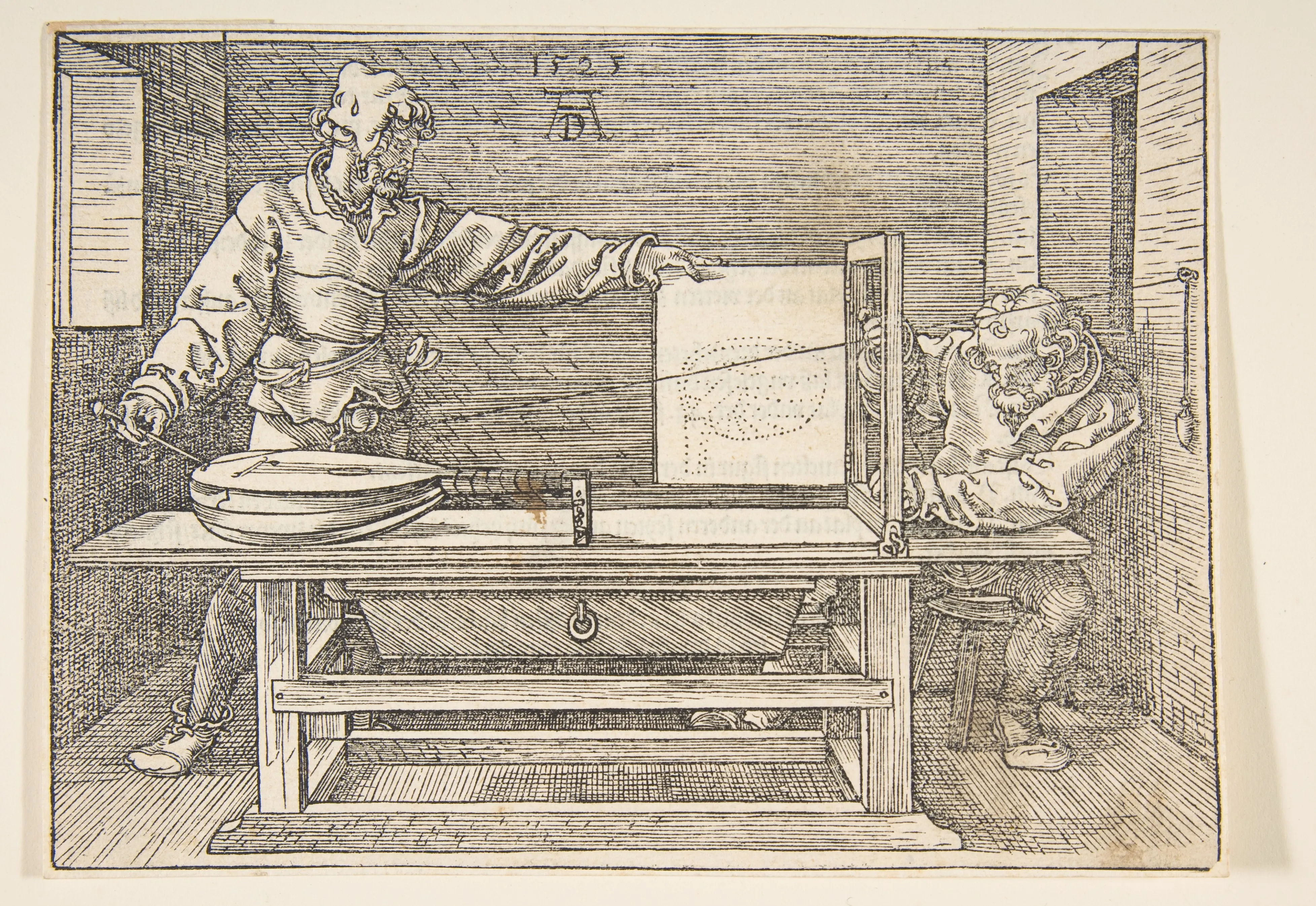
In the following century, Albrecht Dürer invented a device that lets an artist transfer exactly what he sees onto the page. He touches the details of his subject one point at a time with a rod attached by a cord to a fixed point behind him, then marks on the drawing the position of the corresponding cord. As we will see, this gesture stayed in use until very recently.
But the 19th century brought a leap forward in the faithful representation of reality: a process to fix the image formed in a camera obscura. This was the invention of photography (from the Greek photos: light, and graphein: to paint, draw, write. Literally, to paint with light), thanks to the work of Niépce, Daguerre and Talbot.
From then on, every moment could be immortalised. Drawing, painting, engraving and sculpture interpret reality through the eye and hand of the artist, but photography fixes the image it receives on a plate or a film, whether or not the observer’s eye is present. The instrument is said to be objective (objectif is also the French word for a camera lens), and it lets anyone keep a trace of what they love.
While the young Meydenbauer was devising geometric methods to measure architectural heritage without putting himself in danger, Aimé Laussedat, in Paris, had been working since 1845 on a way of taking measurements from photographs of landscapes. He devised the process he named Métrophotographie in 1861 (from the ancient Greek metron, “measure, rule, length, magnitude”). Proof that the idea was in the air: Meydenbauer arrived at a comparable method without knowing of Laussedat’s work, and named it Photogrammetrie in an 1867 article (using the same Greek roots, and refining, on the advice of the geographer Otto Kersten, his provisional terms photographometrie or photometrographie). The technique spread and was then industrialised in Germany, chiefly in architecture, with the founding in 1885 of a Photogrammetric Institute (the Messbildanstalt) under Meydenbauer’s direction. A team of operators could now transfer points by hand from each photographic plate to document the built heritage.
So it was photography that set off this new wave of innovation. But for now, photography is merely another way of projecting the real world onto a two-dimensional plane. How can we recover depth, relief, and therefore distances, from a photograph?
The Third Dimension
To understand simply why a second point of view is enough to recover the third dimension, try a simple experiment. Stretch your arm out in front of you, close one eye, then point a finger at a distant object. Now, staying perfectly still, switch eyes. Your finger no longer points exactly at the object you had picked out. There is an offset between the viewpoints of our two eyes, and objects that line up from one viewpoint no longer do when you change it. This is parallax.
It is precisely this distance between our two eyes that lets our brain reconstruct depth and relief from the two viewpoints. This is called stereoscopic vision (from the Greek stereo, solid body and by extension “in relief”, and scope, sight). It is often suggested that this ability to see in relief (which we also find in most predators) made life in the trees possible for our primate ancestors, for whom judging the distances between branches (or between a cradle and a window ledge) could be a matter of life and death!
Stereoscopy appeared almost at the same time as photography. In 1838, the English physicist Charles Wheatstone, who was working on binocular vision, presented a device that let viewers see drawings in relief using angled mirrors. Soon afterwards, he had Talbot produce the first stereoscopic photographs, in 1840.
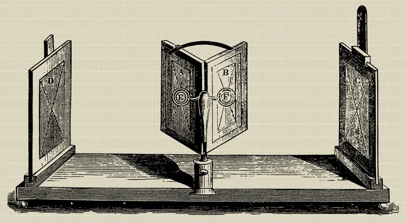
Jacques Babinet, in 1858 in the Revue des Deux Mondes, describes the stereoscope this way: “an instrument that shows all objects in relief, […] thus, the drawing becomes a statue” (translated from the French). In the early 20th century, many travellers and explorers took stereoscopic cameras with them (cameras with two lenses side by side), leaving us a wealth of three-dimensional records from that era.
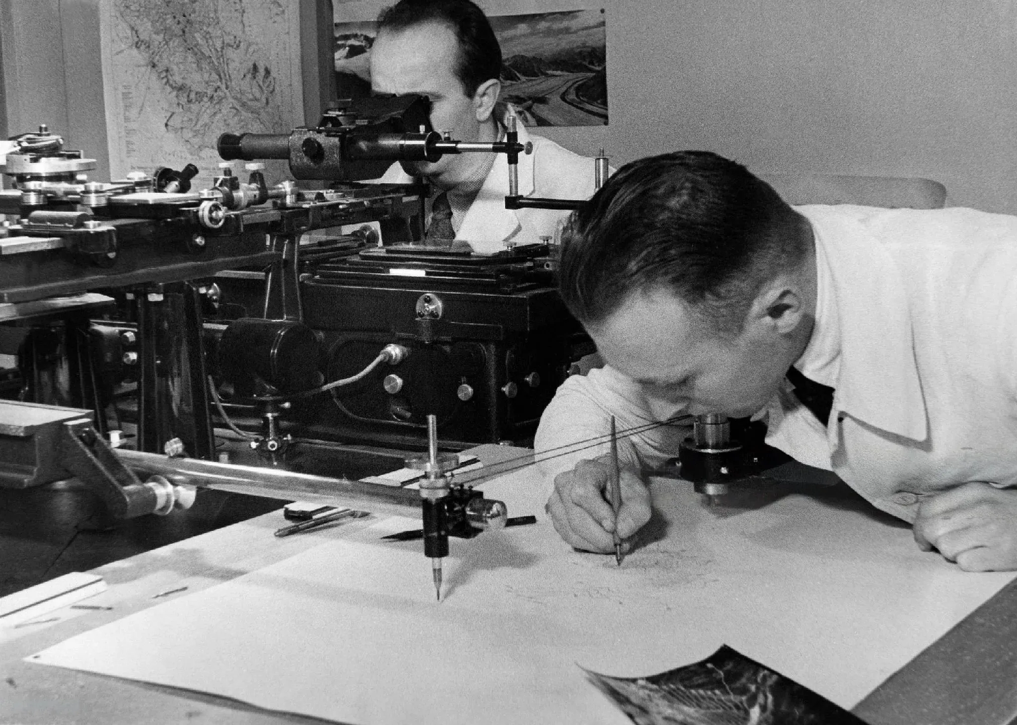
The combination of photography with aviation also enabled mapmaking to progress, particularly in the representation of relief.
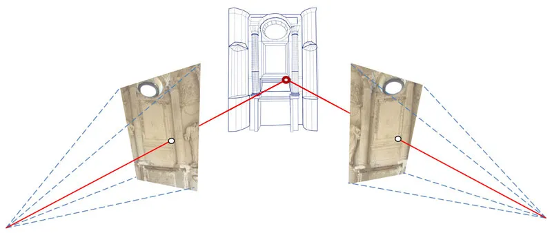
In the early 20th century, the work of the Austrian Erwin Kruppa made it possible to describe mathematically the relative position of two photographs in space, provided five points can be identified in both images. The principle of triangulation then lets us work out the position in space of any point identified in both images. From there, photographing the same subject from several angles lets us reconstruct the scene as volumes after the fact, and measure it.
The arrival of electronics, and then of computing, revolutionised photography, as it did many other fields. The number of shots is no longer limited by the physical medium, shooting and viewing are instantaneous, and the computer helps us store and process all this information. But the computer replaces the tool, not the hand. Every pixel in every photograph becomes the memory of a ray coming from a measurable three-dimensional space.
Measuring, One Pixel at a Time
The first time a building in 3D came out of my photographs was the chapel of Cruzille in Châtenoy-le-Royal (Saône-et-Loire) in 2007. It was the subject of my final-year project, and the moment I learned to reconstruct buildings virtually from photographs, drawing on the work of Livio De Luca (CNRS, MAP) and of Paul Debevec (SIGGRAPH 1996). It is also the project that launched my career and would allow me to digitise, over nearly a decade, dozens of buildings and archaeological objects across Europe.
My most memorable project remains the photogrammetric survey of the Cluniac abbey of Romainmôtier (Switzerland) in 2009. More than 3,000 photos were needed to capture every detail of one of the oldest monasteries in Switzerland, founded in the 5th century (and taken over in the 10th century by the abbey of Cluny, which had the present church built).
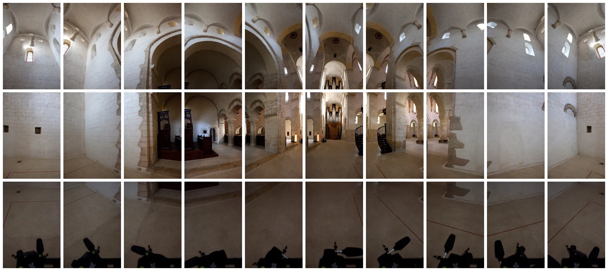
For the interior photos, to limit the number of separate images that had to be loaded at once, I work with 360-degree panoramas. To obtain them, the camera is placed on a mount that rotates it around its optical centre, so that successive shots overlap perfectly. Parallax is thus cancelled within a panorama, then restored between two panoramas taken from different places.
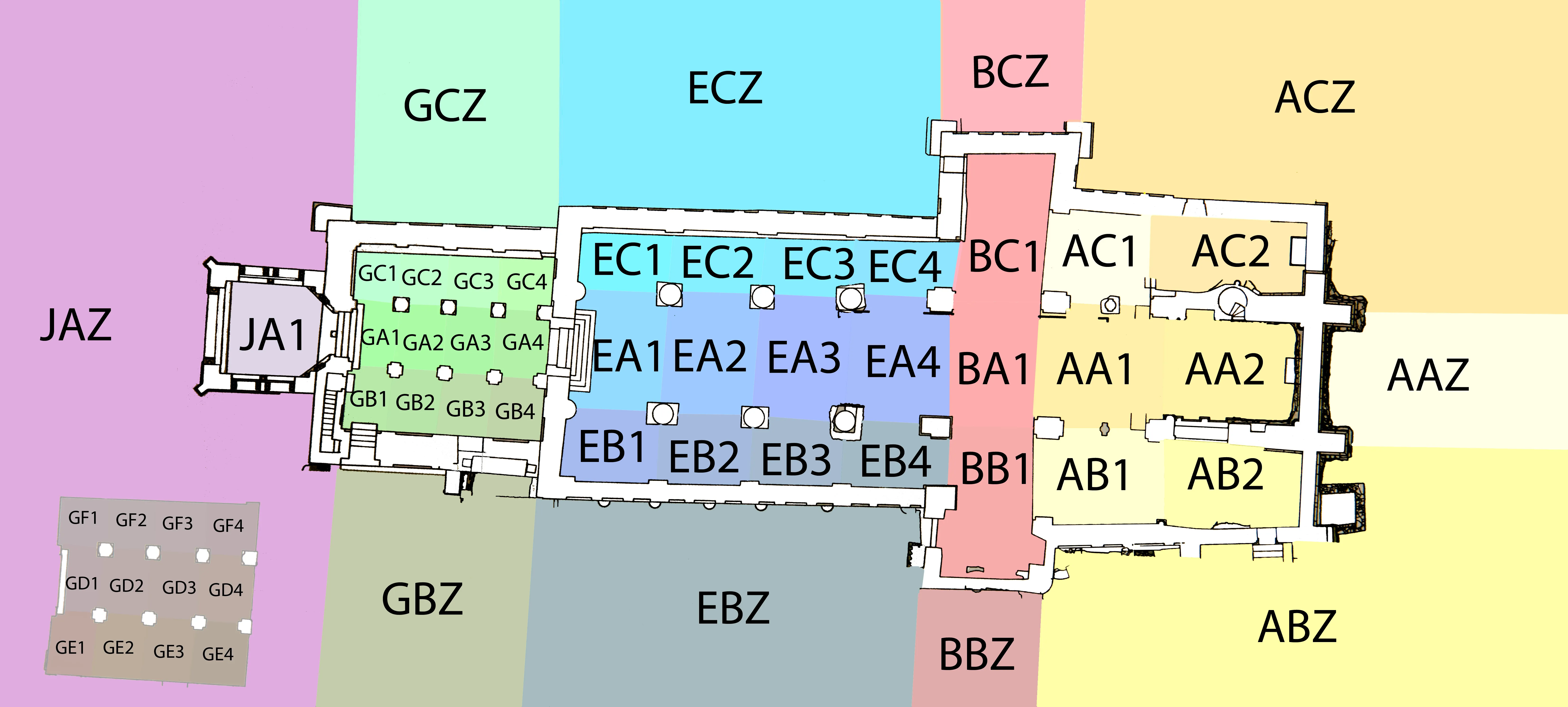
Each panorama is made of about thirty photographs, which I stitch into a single image of more than 300 million pixels. By shooting one at the centre of each coloured section of the church plan (sometimes at several heights), I gather enough information to model every architectural detail.
This was only a few years before drones made aerial photography easy, so I choose (wisely, judging by Meydenbauer’s misadventures) to use a small scaffold to reach the upper parts, and to look for stable vantage points overlooking the church for the exterior shots.
Even if the shoot goes off without a hitch, it is only a tiny part of the work still to come. At the end of the 2000s, the main method available to me is manual photogrammetry, using the software Autodesk ImageModeler. With two photographs displayed side by side, I find at least five points common to both images. Zooming in as far as possible, I click on the pixel in each that represents the same point on the photographed subject, in the manner of Dürer pulling his cord. Once these five matching points are established, the software can deduce from this information, together with the characteristics of the camera, where the photo was taken from. Each additional point I add to these now-calibrated images can serve as a 3D marker for building the digital model.
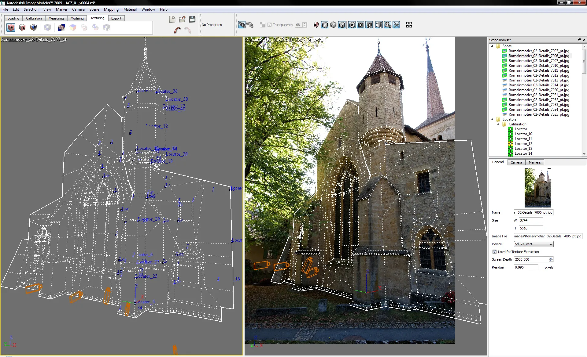
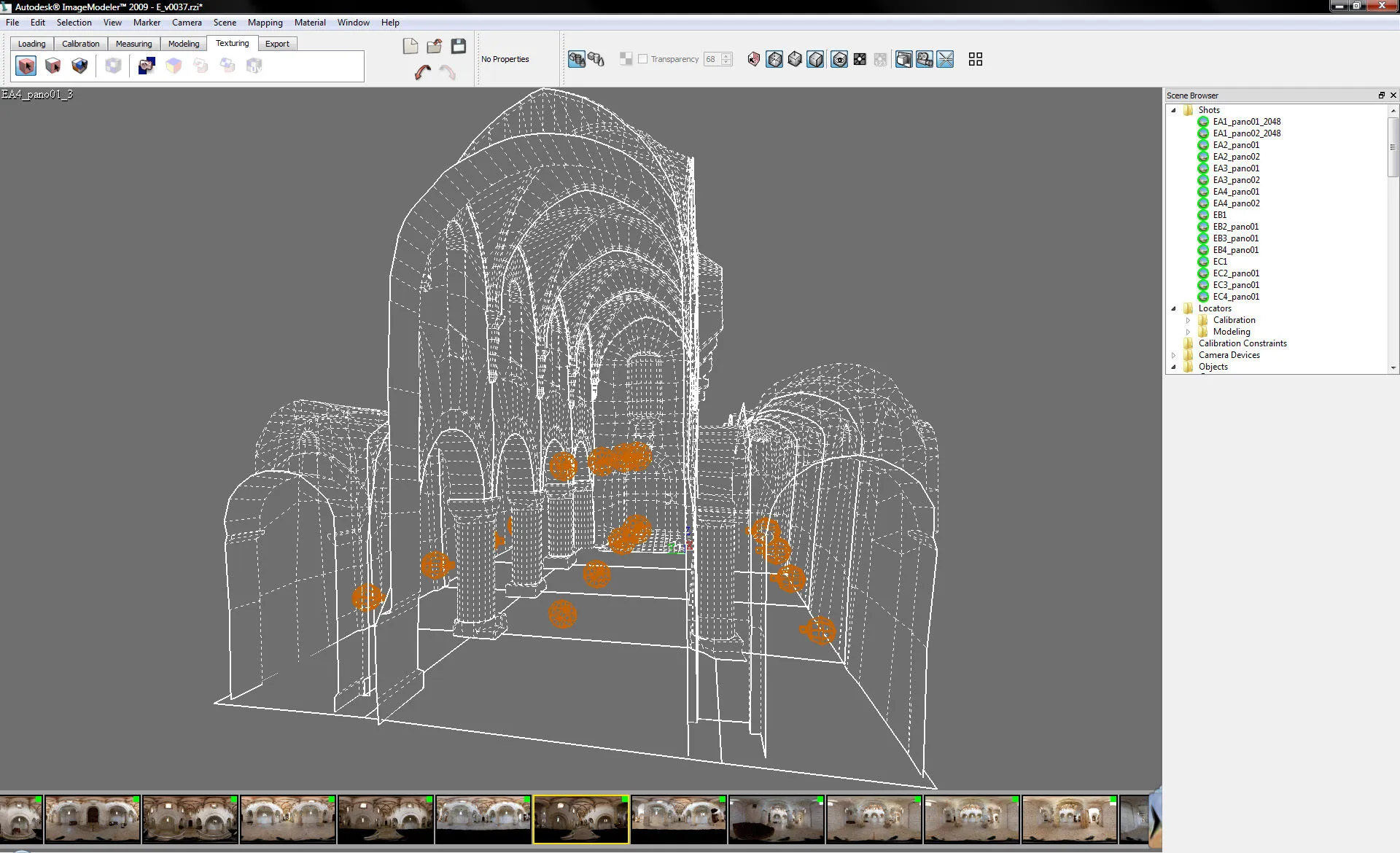
To digitise an entire building (inside and out), every detail must therefore be seen in at least two photographs, and each of the hundreds of photographs of the project must be referenced in 3D space. To do so, I manually indicate, step by step and image by image, which points (a window corner, a detail in a stone or something else, in blue in the image above) are identical from one photo to the next. I remember, without much nostalgia, once spending a whole day zooming in on a grain of gravel slightly paler than its neighbours to be certain it was the very same one as in the twenty previous photos! The computer has no idea it is the same grain of gravel. It is up to me to tell it.
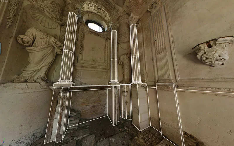
From there, my scene is ready for the modelling proper (creating the volumes, the 3D model). I draw, using two (or more) viewpoints at once, the geometric shapes that represent the visible surface of each architectural element (the white lines in the image above). Since this operation is also entirely manual, I limit myself to the general shapes of the building. Modelling every relief and every detail would be out of the question in any reasonable amount of time.
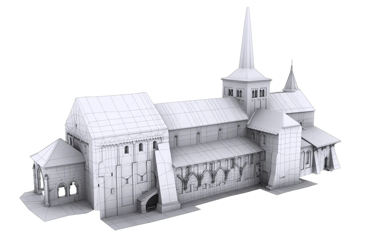
One of the main advantages of this method (besides the speed of capture compared with a laser survey, for example) is that portions of the photographs can be used as textures for the 3D model. I thus get a realistic rendering containing every visual detail of the photograph without having to create detailed geometry. Simple geometry, rich texture.
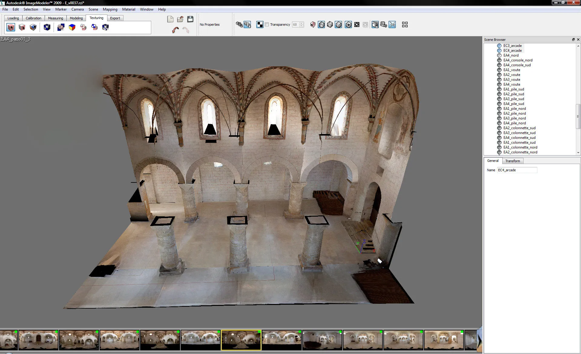
Two days in the field, and more than six months full-time in front of a screen. At this rate, the manual method will let me survey only a handful of buildings in a lifetime…
If you look closely at the cross-section above, you can see a few black patches (above the pillars, the bottom of the windows in the central bay). These are areas that were hidden in the photographs, blocked by something in the foreground or simply out of reach. They are pockets of missing information.
Blind Spots, or How to See from Above
Our memory forgets, and fills in the gaps. Photography, for its part, forgets nothing: it captures reality, and gives us the memory of a ray of light with which to measure and represent what we wish to keep and preserve. But at the same time, it invents nothing. It shows only what it has recorded, and if the photographer misses certain viewpoints, they cannot be reconstructed after the fact.
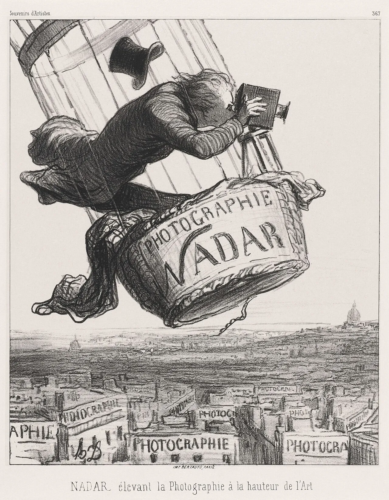
Ever since Meydenbauer’s fall in Wetzlar, we have been trying to see from above without climbing. Some people mount the camera on a mast to gain a little height. Nadar rose above Paris in a balloon to photograph the city. Aviation made it possible to crisscross the sky and map entire territories, and then the space age put cameras in orbit around our planet. But for more than ten years, affordable drones have put every viewpoint needed to digitise a building within reach, and even let us plan the camera’s flight path in advance and leave the drone to fly itself. Magic.
The Price of Measurement
Photogrammetry lets us measure a complex building such as an abbey church without putting ourselves in danger. No more climbing! The price has changed in kind. It is no longer paid in physical risk but in time and patience, sitting in front of a screen, recognising the same pixels from one photo to the next.
What if the machine could recognise for itself what it is looking at?
We will take a first step toward the answer soon, in episode 2 (A Balloon over Cluny) of the series “Do Machines Dream of Abbeys?”
To be continued…
Sources
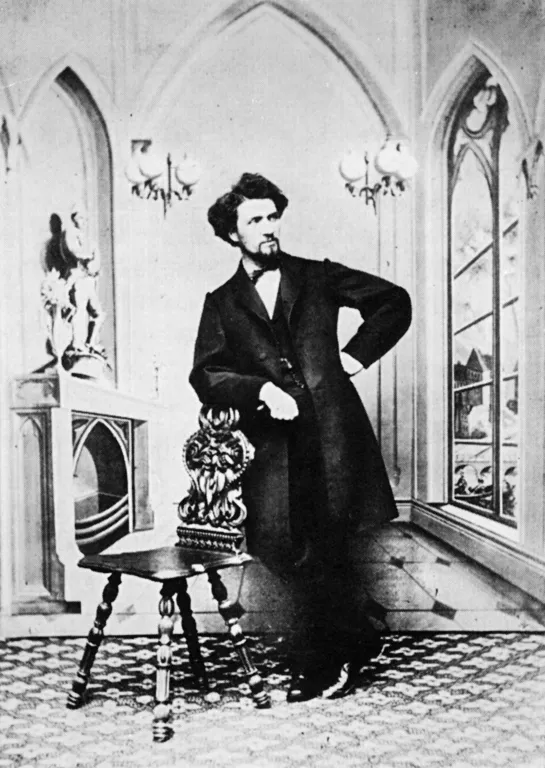
Albrecht Meydenbauer
- Albrecht Meydenbauer Wikipedia
- Albrecht Meydenbauer: Die Photometrographie. In: Wochenblatt des Architektenvereins zu Berlin. Jg. 1, 1867, Nr. 14, S. 125–126 (Digitalisat); Nr. 15, S. 139–140 (Digitalisat); Nr. 16, S. 149–150 (Digitalisat).
- Jones, E. L., “The Art of Measuring Images”, Drawing Matter Journal n°2, 2023 Link
- Meyer, R. (ed.), Albrecht Meydenbauer: Baukunst in historischen Fotografien, Leipzig, VEB Fotokinoverlag, 1985, p. 15-16 (Meydenbauer’s journal, as cited in note 4 of Jones).
- Bildarchiv Foto Marburg, Meydenbauers Messbildverfahren
Laussedat, Nadar
- Polidori, L., “On Laussedat’s contribution to the emergence of photogrammetry”, ISPRS Archives XLIII-B2, 2020, p. 893 (PDF).
- Nadar’s patent, 23 October 1858, INPI Archives.
- Honoré Daumier, Nadar élevant la Photographie à la hauteur de l’Art (Nadar Elevating Photography to the Height of Art), lithograph, Le Boulevard, 25 May 1862 (printer: Bertauts). National Gallery of Art.
Places
- Entry for the chapel of the château de Cruzille (Saône-et-Loire) in the Mérimée database
- The abbey church of Romainmôtier (Switzerland), Wikipedia
- The Dom of Wetzlar, Wikipedia
Perspective
- The Literary Works of Leonardo da Vinci, ed. Jean Paul Richter, 1883 (fromoldbooks, item 83).
- Dürer, Underweysung der Messung, Nuremberg, 1525 (Met entry).
- Kruppa, E., “Zur Ermittlung eines Objektes aus zwei Perspektiven mit innerer Orientierung”, Sitzungsberichte der Akademie der Wissenschaften in Wien, 1913 Translation
Stereoscopy
- Wheatstone, C., “Contributions to the Physiology of Vision. Part the First. On Some Remarkable, and Hitherto Unobserved, Phenomena of Binocular Vision”, Philosophical Transactions of the Royal Society of London, vol. 128, 1838, p. 371-394 (read 21 June 1838). stereosite.com
- Babinet, J., article on the stereoscope, Revue des Deux Mondes, 1858
- Drawing Matter Journal, “The Stereoautograph”
Photogrammetry
- Grimm, A., “The Origin of the Term Photogrammetry” ISPRS.
- Debevec, P. E., Taylor, C. J., Malik, J., “Modeling and Rendering Architecture from Photographs: A Hybrid Geometry- and Image-Based Approach”, SIGGRAPH ‘96 Proceedings, August 1996, New Orleans. Berkeley
- And of course, the reference book that has accompanied me throughout my career: Livio DE LUCA, La photomodélisation architecturale: relevé, modélisation et représentation d’édifices à partir de photographies. Eyrolles, 2009. 264 p. ISBN 978-2-212-12524-5.